Best Walks in and around Cramlington
Published walking routes in and around Cramlington: the four miles of paths at Northumberlandia, short and longer loops along the River Blyth in Plessey Woods, and the National Trust's Wagonway walk from Seaton Delaval Hall.
Cramlington has a lot of green space close to hand. Our parks and green spaces guide covers what each place is like. This guide is about the walking itself: published routes you can follow, with where to start, how far they go and what the ground is like underfoot. Distances and times come from each route's own source, so you can check the full details before you set out.
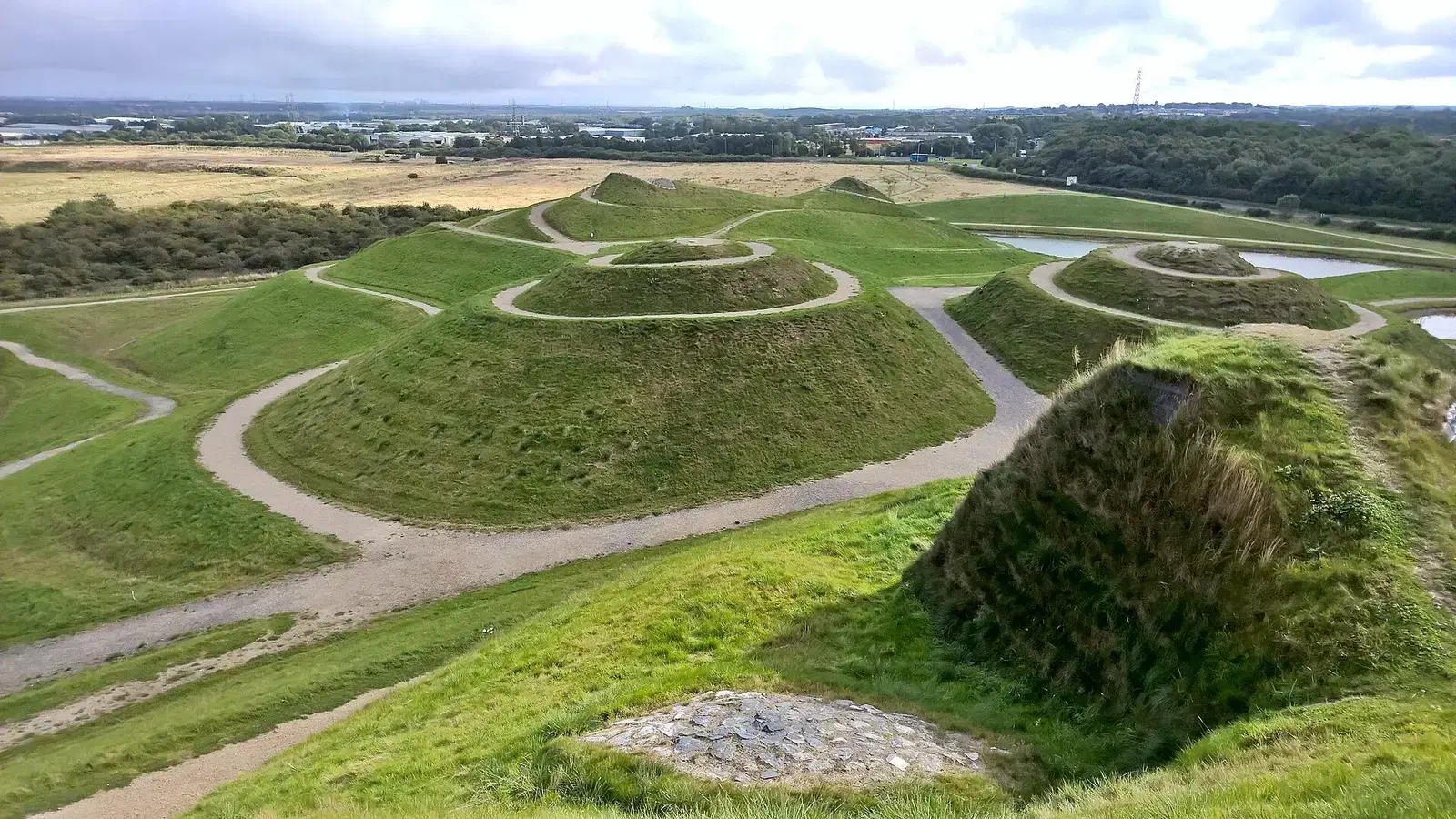
Northumberlandia: paths on and around the landform
The easiest walk to reach from town is at Northumberlandia, the reclining landform figure on Blagdon Lane (NE23 8AU). Northumberland Wildlife Trust, which looks after the site, says the 46-acre community park has four miles of footpaths on and around the landform. You can make the walk as short or as long as you like, from a loop at ground level to the climb onto the head for the view.
The site is open from dawn to dusk every day. Entry is free and there is plenty of parking on site, with a suggested £2 donation for the car park. The Trust says the approach to the sculpture from the car park is fully accessible at ground level, though wheelchair users may need a Radar key for the kissing gate when the site is not staffed. Dogs on leads are welcome on site and in the cafe.
If you would rather not drive, the Trust says the X21 and X22 buses stop at the Beacon Hill Fisher Lane roundabout, about ten minutes' walk away by a gate and path. Afterwards, the Northumberlandia Cafe in the visitor centre is open from 10am to 4pm, with hot food until 3.15pm, and the toilets keep the same hours.
Best for:
At the time of writing, the Trust lists the woodland trail as closed because of a fallen tree. Check its Northumberlandia page for closures before you go.
Plessey Woods: along the River Blyth
Plessey Woods Country Park lies off the A192 at Hartford Bridge, on the way to Bedlington. Its paths through woodland, meadow and riverside are used by walkers, cyclists and horse riders, and the Woodland Trust notes a wide, firm path through the woods and along the river that suits visitors with disabilities. There are two well-documented routes.
The short riverside loop. 10Adventures publishes an easy 2.7km walk taking 30 minutes to an hour. It starts at the south-east corner of the car park, heads south past the visitor centre, toilets and play area, crosses Pegwhistle Burn and follows the River Blyth through Valley Wood and Quarry Wood before looping back. Dogs are allowed on a lead.
The longer woodland and gorge walk. Countryfile describes a moderate 3.3-mile (5.2km) circuit of about two hours. It runs from the picnic area through young woodland and coppiced trees, where the bluebells are thickest in spring, then drops steeply into the gorge of the River Blyth. Look out for herons, dippers and great spotted woodpeckers. You can carry on along the riverbank for another mile beneath the railway viaduct, or return past The Pool, where steps climb to a hay meadow and back to the park.
Parking at the main entrance is pay and display, with the first hour free; the council lists £3 for up to two hours and £5 for longer at the time of writing, and Blue Badge holders park at no charge. The vehicle gates are open during daylight hours, and the visitor centre (01670 824793) has a cafe and toilets.
Best for:
Countryfile warns of an often-muddy track and a steep drop into the gorge, and 10Adventures says the paths can be quite wet and muddy in winter and spring. Waterproof boots make a big difference here.
Seaton Delaval Hall: the Wagonway walk
For a longer outing with some history, the National Trust's Wagonway walk at Seaton Delaval Hall is a short drive east of town. It is a 4-mile (6.4km) route rated easy, taking about two and a half hours, starting from the hall's main gates (NE26 4QR).
The route follows the old wagonway with views back to the hall, and passes the Church of Our Lady, Harbord Terrace (built for estate workers in 1879 to 1890), the foundation stones of a timber viaduct in Holywell Dene and the harbour at Seaton Sluice and Charlie's Garden, and the Mausoleum, built in 1777. In winter you may spot the remains of Starlight Castle. The obelisk you can see is on private farmland and cannot be reached.
The hall has a free car park with blue badge spaces, toilets, and the Brewhouse Cafe, open 10am to 4.30pm. If you are coming by bus, the 57 and 19 both run through Seaton Delaval, as covered in our guide to getting around without a car.
Best for:
The Trust says this walk is not suitable for dogs. It is mostly flat over rough tracks and pavement, but there are two stiles, some steep steps and muddy patches.
Walking from your front door
You do not always need to drive to a walk. Cramlington was built with a network of paths and cycleways that keep you away from the main roads, linking the estates with the town centre and parks such as Alexandra Park and Valley Park. National Cycle Route 725 also runs through the town towards Blyth, though parts of it are still incomplete. Our getting around guide has more on the path network.
Tips before you set out
- Footwear: all three routes have muddy stretches, so wear waterproof boots for most of the year.
- Dogs: dogs on leads are welcome at Northumberlandia and Plessey Woods. The Seaton Delaval Wagonway walk is not suitable for dogs.
- Livestock: the longer Plessey Woods walk runs beside pasture, so keep dogs under close control near fields.
- Daylight: Northumberlandia is open dawn to dusk, and the Plessey Woods vehicle gates are open during daylight hours only, so leave time to get back to the car.
- Closures: paths close for fallen trees and repairs. Check each site's own page before you set off.
For more ideas for getting outside, see the outdoors hub.
Spotted a change? Get in touch and we'll update the guide.
Never miss what’s on
Join the weekly Cramlington.live digest — the best events, news and local tips, straight to your inbox. One email a week.
What's On
Remembrance Sunday in Cramlington
10:00 AM · St Nicholas Church, Blagdon Terrace, Cramlington NE23 6QQ
The Carrivick Sisters at Cramlington Folk Club
8:00 PM (doors 7:30 PM) · The Benedictine Social Centre, Glenluce Drive, Southfield Green, Cramlington NE23 6YA
Wilder Wellbeing at Northumberlandia
11:00 AM - 2:00 PM · Northumberlandia, Blagdon Lane, Cramlington NE23 8AU